Sunday, July 6, 2014

Shingletown and Beyond

I spent the 4th of July this year exploring the back roads around the Shingletown, California area in the company of a friend that I have known since my teen years. It proved to be quite the adventure to say the least.  Mike knows Shasta County like "the back of his hand", as the saying goes, and is an avid history buff as well, and so our day was filled with driving down bumpy dirt roads and hiking in and out of canyons, all with the added element of Mike's story-telling quality narratives about the area in general, and of his personal experiences as a kid.  Mike gave me a copy of Dottie Smith's "Dictionary of Early Shasta County History", and we used it for reference through the day.  Much of the information in this post is derived from that publication and Mike's memories.  
Our day started with an early lunch at the "Cinnamon Bear Cafe" off Highway 44 just west of Shingletown.  They serve one of the best cheeseburgers I've had in a long time, and it was good fuel for the exercise that was to come.  
Our next stop was the McCumber Reservoir, which is fed by Battle Creek and and is part of the Battle Creek Hydroelectric System.  The Reservoir was built by the Northern California Power Company in 1907.  


View of the Reservoir from the road.
 Looking across the top of the dam toward Battle Creek.
A view across McCumber Reservoir. . 


Our next destination took us east of Shingletown to Sites Road, and that's when things got really interesting.  I came prepared for "rural", but this was more than I anticipated.  Fortunately, Mike has the truck equipped for these types of roads, and I still have enough country girl in me to have been up to the challenge.  We drove to a spot where I deemed it was prudent to change into my walking shoes.  That proved to be a good decision, as we headed down a steep incline to Upper Battle Creek Canyon.  The walk down was somewhat treacherous, but what a treat when we arrived at the bottom!  


It was a hot day, and you could feel the drop in temperature as soon as we reached this park-like setting along the Creek and the diversion ditch below Battle Creek Dam that runs to Nora Lake.  The trees are majestic, and the ferns and grasses are lush.  


Battle Creek Dam

We counted 7 trout in these waters below the Dam during our brief visit.  


Following the ditch southwest from the Dam, we walked on a flue for a short distance, and enjoyed a small spring emptying into the ditch.


I found myself challenged by our trek back up to the road, but when Mike told me that his father had last made this same walk when he was 91, I decided it would be downright embarrassing to register any complaints.  Talk about setting the bar high! 

Next stop on the adventure was the ghost town of Plateau on the east side of Battle Creek Bridge and Shingletown Ridge.  Plateau was settled in the early 1880's, but the settlement was very short-lived due to a lack of water.  The Northern California Power Company purchased the property in 1908, and a forest fire consumed most of the homes still standing in 1917.   There remain a few hardy souls still calling the area home.

The Cunningham family homesteaded in Plateau, and their family cemetery is still in evidence close by.


Cunningham Family Cemetery

 The headstones of Abraham and Samantha Cunningham, who died less than 2 months apart in 1896, indicate they are "Father and Mother". 


Bridge overlooking Battle Creek Canyon and Falls, west of Plateau
Battle Creek Falls, where Mike and his son rappelled down a very scary cliff to fish in the beautiful pond below.  The "copious amounts of wild rainbow trout" in the pond make the harrowing descent worthwhile according to Mike.  I'll take his word for it. 


This view of the Battle Creek Canyon from the bridge is spectacular in person.  It's tough to portray it in a photograph to really do justice to the drop and ruggedness of the terrain.  


This massive chimney is all that remains of a home that was built on the west side of the creek, overlooking the Falls.  We walked (crawled) around the far side to get a better perspective of what the view must have been for the residents of the home.  It is assumed from the bits and pieces of foundation around the chimney that the home extended out over the cliff, affording the occupants a magnificent (albeit somewhat frightening) vantage point.  The home succumbed to a fire at some point, but Mike remembers when it was still standing.  


 We headed next in the direction of Nora Lake, making a stop at the Klotz Factory site, where remnants of the building foundations and orchard trees are discernible.  The Klotz family cemetery is located across the "road".  The cemetery has a park-like feel to it, with beautiful, mature trees and ivy covering the ground.  We found headstones for Rudolph Klotz, the founder of the Klotz Factory, and two headstones for children of Rudolph and Annie Klotz.  


Klotz Family Cemetery

We made a brief stop at Nora Lake before driving the short distance up the road to the site of "Noble's Bungalow", also known as "The Castle".  The home was build by Hamden Noble in 1903, and overlooked the Manton Valley.  The home burned during the 1917 forest fire.  


Nora Lake


Grace Lake


Nora Lake was built in 1900 and Grace Lake in 1906 as reservoirs for the Battle Creek Hydroelectric System.  The lakes were named for H.H. Noble's daughters, and are a popular family outing destination for those in Shasta County who know how to find them.  I have a hunch that most people access these lakes from Wilson Hill Road out of Shingletown.  Certainly, that is the more direct, easier route.  Unfortunately, taking that route means that you miss all the wonderful history that Mike showed me on our very fun trek across the back roads.  I'm glad I didn't have to miss it! 


Portland, Oregon

If you visit Powell's Book Store in downtown Portland, you will find hundreds of books on their shelves that tell, both through written word and photographs, about the beauty and diversity of this area.  There were several reasons driving my decision to move here in 2007, and the geography was certainly one influence.  The city of Portland is one of the prettiest you will see anywhere, with the Willamette River running north through the city to join the Columbia River where it divides Portland from Vancouver, Washington.  There are 11 bridges spanning the river, beginning with the Sellwood Bridge to the south and ending with the St. John's Bridge to the north, providing links between the west and east sides of the city.  It is a bit tricky getting around in this metropolis, and I have found my GPS to be invaluable.  Before buying my Honda, I used a Thomas Guide to the point that the pages started falling out.  To say that Portland is one hill after another is no exaggeration, and there are blocks of the downtown area where you simply cannot make a turn.  After 6 years, I still try to plan my route to consider both directions and the time of day, in order to avoid confusion and frustration.  It would be difficult to identify one area over another as a favorite for me.  Part of the charm of the city is that there are so many divergent opportunities to explore and experience the beauty of the area.


Washington Park overlooks the City, with views of Mt. Hood, and includes the Rose Garden, Japanese Garden, walking trails, and the Arboretum.  


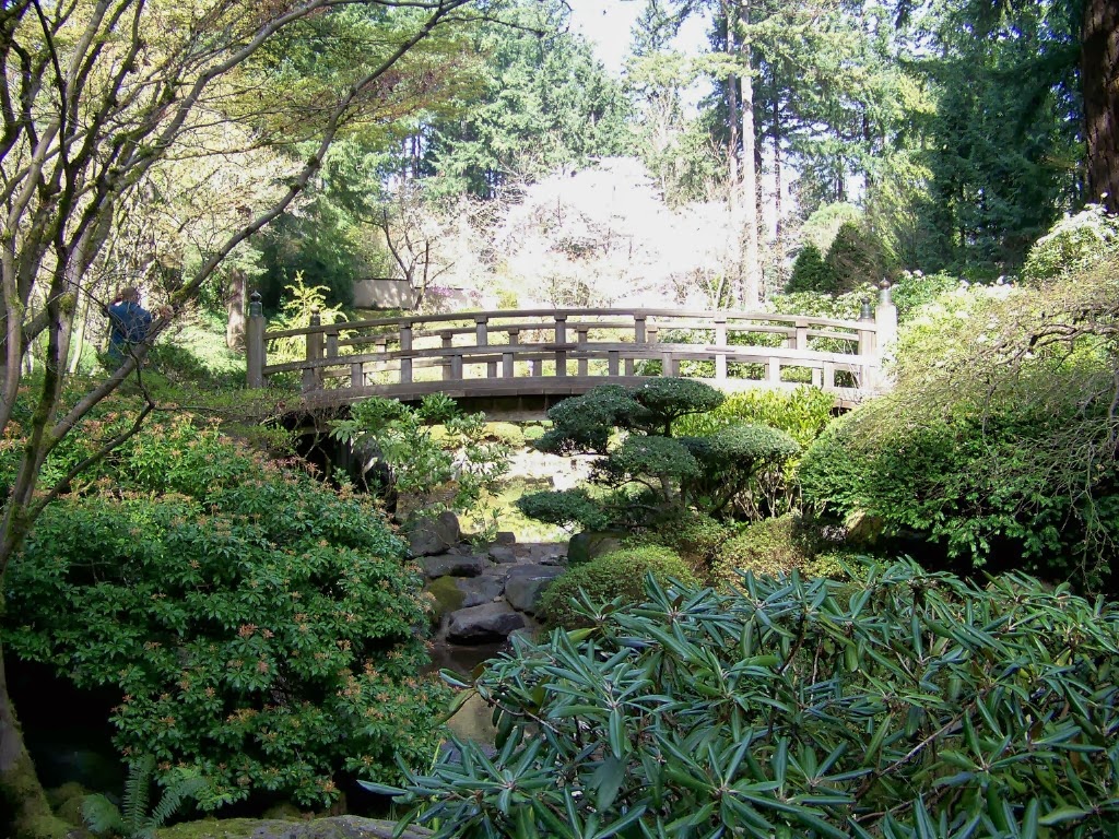
In my world, a visit to Portland is not complete until you spend some quality time experiencing the beauty and serenity of the Japanese Gardens.  I have spent many hours here at different times walking, watching and simply soaking in the peaceful environment of this very special gardens.  I have dedicated a full blog post to the Gardens, but wanted to include a few of my favorites here.


My townhouse was located a couple of blocks from the Nike World Campus in Beaverton, and I took advantage of their extensive walking paths on a regular basis.  The Campus includes a large pond in the center, where geese made themselves at home, and the surrounding path takes a walker through a japanese-style garden and a grove of bamboo.  I never learned the identity of the artist commissioned to create the sculptures that made their home on the Campus, but always enjoyed finding them in unexpected places.

Japanese Garden area of Nike Campus


Two examples of the sculptures to be found at Nike World Campus.


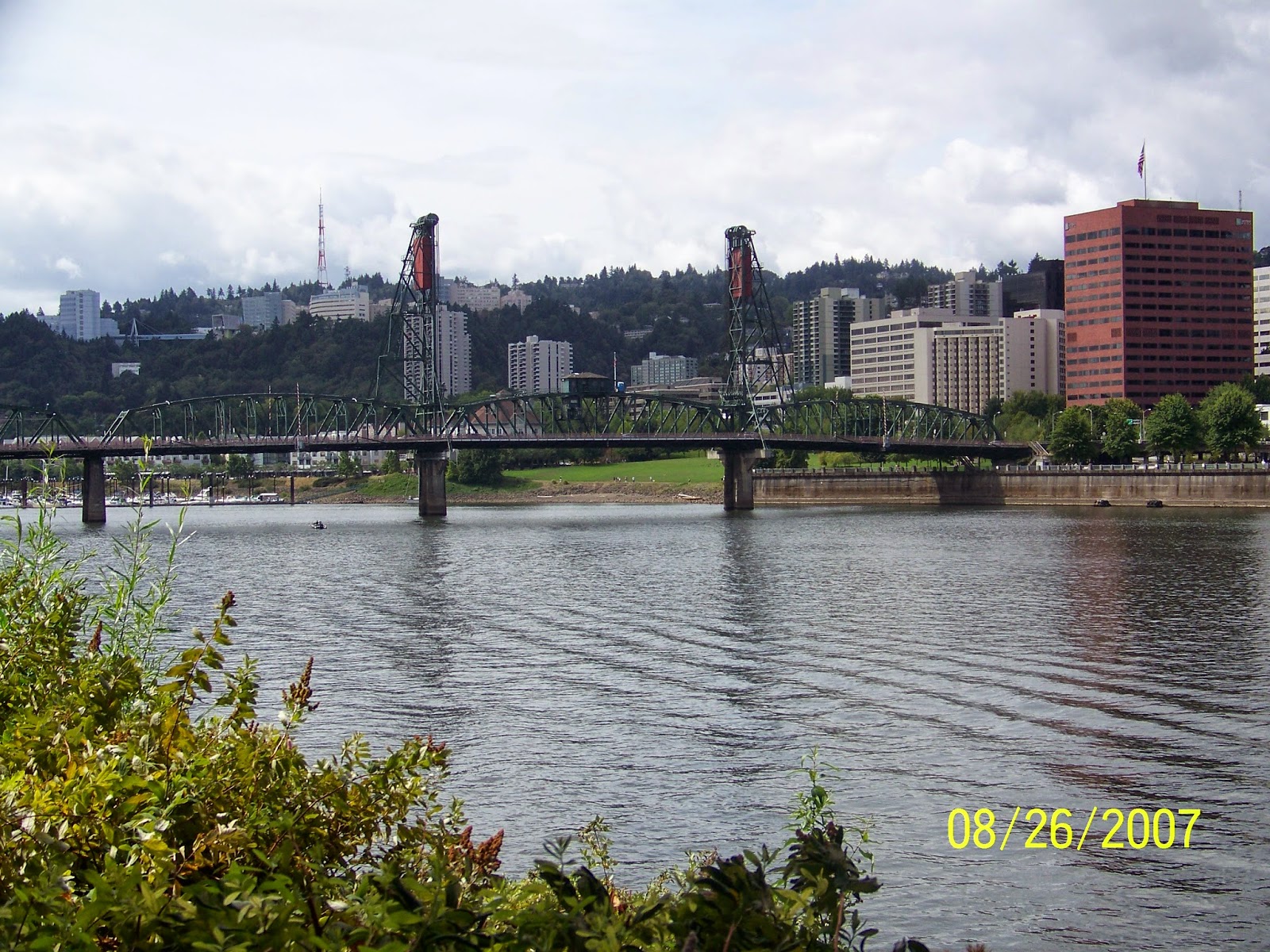
The Portland waterfront offers some really special views of the city and the bridge system.  There are miles of waterfront walking trails, as well as boating opportunities up and down the Willamette.


Monday, July 29, 2013

Columbia Gorge


It would be difficult for me to guess how many times I have traveled between Idaho and Oregon (and back again over the years), but suffice to say that in spite of the beauty and variety of scenery you encounter, the drive has become somewhat tedious for me.  Since my children and grandchild still live in Idaho, and I really don't wish to make my home there again, I decided that I would have to do what I could to change my route in order to create some interest and enthusiasm for the trip.  One alternative is to take Highway 14 on the Washington side of the Columbia Gorge, rather than I-84 on the Oregon side.  It is a two-lane highway, with some twists and turns, and drivers have to be ready to spend some time following trucks making their way (very slowly) up some rather steep hills.  But from my perspective, the views of the Gorge and the surrounding countryside make those minor inconveniences worthwhile.


A view of the elegant, somewhat "other-worldly" windmills that dot the landscape along the Gorge.  There are literally hundreds of these beautiful structures, reaching for the sky at an impressive 41-story height.  Seattle Times article

 The  Maryhill Museum sits above the Gorge just west of the Hwy 97 intersection with W14 and I-84, and features an impressive variety of art exhibits throughout the year.  If art isn't your thing, the surrounding grounds and views of the river are worth stopping to see.


Sculpture on the Museum grounds


The Maryhill Winery is located just a mile or so west of the Museum, and also offers some spectacular views.  Though I cannot say that I have been very impressed with the quality of the wines they produce, the setting is spectacular, and they host some pretty big names in concert there in the summer months.

Outdoor seating at the Winery


concert stage below the Winery
As you continue west on Hwy 14 toward Vancouver, the scenery just gets better, passing through the Columbia Hills State Park area and a section of the Lewis & Clark Scenic Byway in the area.  There are many camping and hiking opportunities along the way.

Mt. Hood from WA Hwy 14


I've also enjoyed watching the wind surfers on the Columbia when traveling through the Gorge, and was especially pleased to get some nice close-up views of this guy showing off his skills.


As you continue west on 14 toward Vancouver, you go through several tunnels on the highway that caused me to take a deep breath.  My brother Jim (the truck driver) assures me that two of the big semis can pass each other in these very narrow spaces, but I wouldn't especially want to give it a try.


Another common sight on the Columbia.....

If you chose to cross over to the Oregon side of the Gorge before reaching Vancouver, one option is to take the Bridge of the Gods.  


Sunday, May 26, 2013

Northern California

What better place to start my travel stories than the area where I grew up.  Northern California is filled with history and beauty.  My family has lived in the Redding area since the early 1950's, and while some have moved elsewhere (myself included), my mother, two brothers and two sisters live there still - which, of course, means that I visit often.  Redding is well known for extreme summer heat.  It is common to have temperatures in the 90 and 100-degree ranges in July and August.  Fortunately, the lakes and rivers are close by, and it's only a short drive to the mountains, north, east and west of the valley.

Shasta Lake and Dam are situated a short 10-minute drive north of Redding.  This particular view is from Shasta Dam Boulevard, with Mount Shasta in the background.  All you could ever want to know about Lake Shasta


Shasta Dam Boulevard south from the Dam takes you back to Redding, with a view of the valley and Mount Lassen to the East.  Mt Lassen is an active volcano, with an elevation of somewhere around 10,000 feet.  It's a pretty drive from Redding, and a nice place to go in the summer when you want to cool off.


The Sacramento River winds through Redding, offering many picturesque vantage points and a number of walking trails that provide opportunities for a closer look.


Mt. Shasta is a spectacular mountain, with an elevation of just over 14,000 feet.  It is an active volcano, and has been a recreational draw over the years for hiking, skiing, etc.  This picture was taken at a view point on I-5, just south of Dunsmuir.  Views of the mountain continue until you climb the Siskiyou Pass north of Yreka.   

I took this picture of the Trinity River on a trip from the coast down to Redding, following Highway 299.  It's a very winding, two-lane road, and you have to be prepared to take your time and accept that your progress will be slowed by logging trucks and recreationists along the way.  That's fine with me, because I want to be able to enjoy the view and stop for the occasional shot like this one to remember the day.


Burney Falls is a real treasure of Northern California.  I visited there with my Mom and niece Mallory in April, and it was so worth the hour and a half drive east from Redding.  This view point is at the top of a steep trail that leads to the base of the Falls.  There are a couple of hiking options around the area, as well as camping in the park.  Burney Falls State Park


I visited the Clear Creek Overlook with my brother Don and sister Wilma on a recent visit to Redding.  The BLM recently constructed this great space which provides a beautiful view of the Creek with shaded areas and tables.  There is a hiking trail nearby.  BLM trail info for Shasta County